Historical Maps of the Roman Empire
MAP COLLECTIONS & atlases
- Atlas of Ancient and Classical Geography (J. M. Dent & Son, 1912)
- 40 maps that explain the Roman Empire (vox.com)
- Historical Maps of the Roman Empire (University of Alabama)
- Maps of Ancient Rome
- Mapping Past Societies (Harvard University)
- Rappresentazioni Cartografiche Storiche della Città di Roma (Geoportale cartografico - Roma Capitale)
- The Roman Empire: 18 Centuries in 19 Maps (Howard Wiseman)
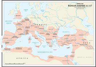
- The Provinces of the Roman Empire
MAPS
- Ancient Italy, 600-300 B.C. (undevicesimus)
- Plan of Rome - Neighbourhood of Rome (Droysens Allgemeiner Historischer Handatlas, 1886)
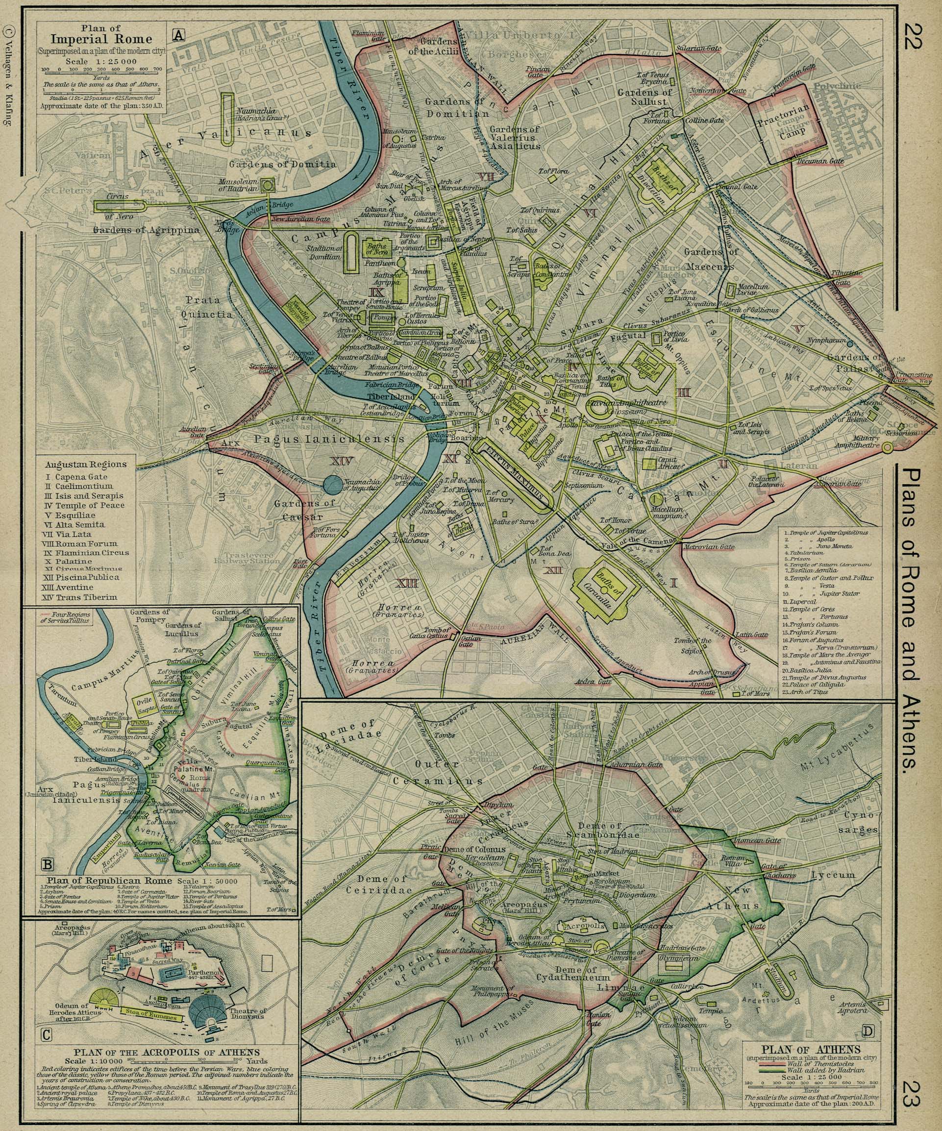
- Plan of Republican Rome (William Shepherd, Historical Atlas, 1926)
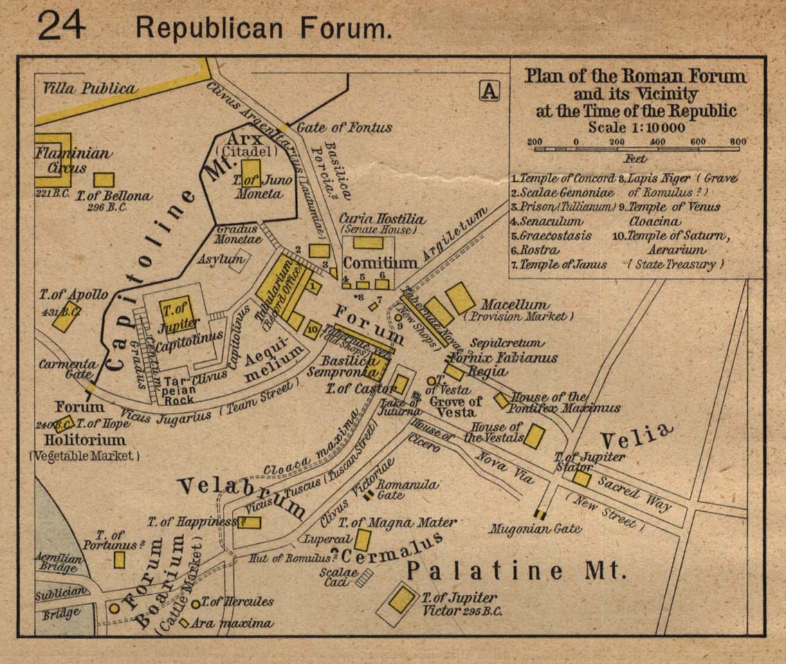
- Plan of the Roman Forum and its Vicinity at the Time of the Republic (William Shepherd, Historical Atlas, 1923)
- Plan of Imperial Rome (William Shepherd, Historical Atlas, 1926)
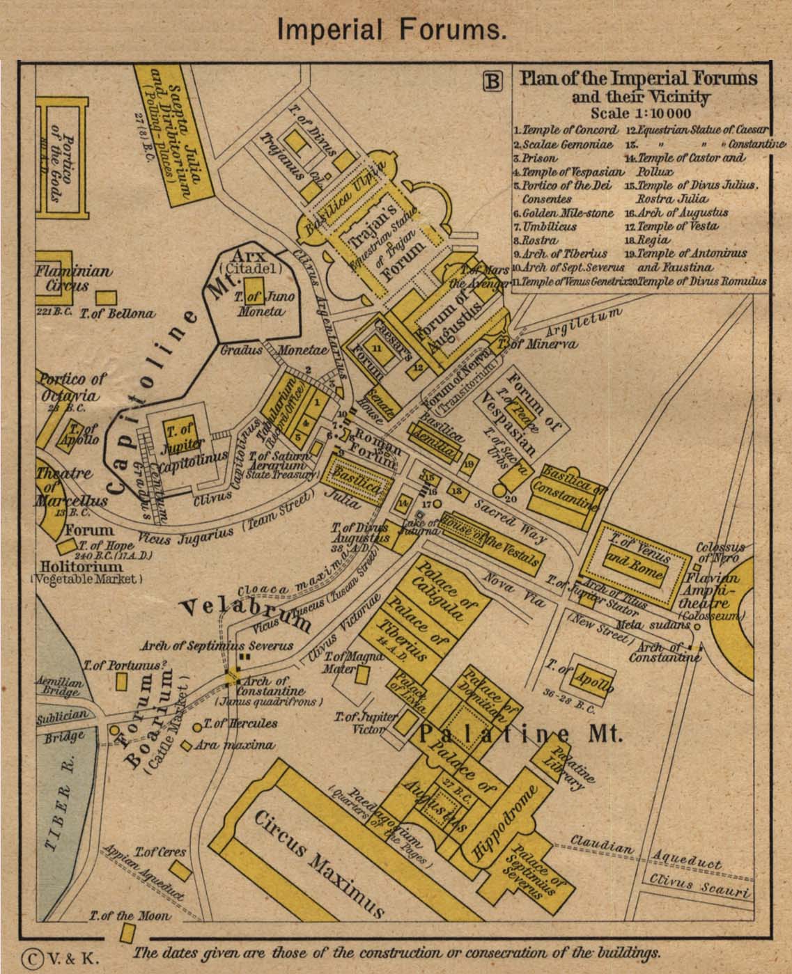
- Plan of the Imperial Forums and their Vicinity (William Shepherd, Historical Atlas, 1923)
- Italy (Droysens Allgemeiner Historischer Handatlas, 1886)
- Italie ancienne a (Vidal-Lablache, Atlas général d'histoire..., 1912)
- Italie ancienne b (Vidal-Lablache, Atlas général d'histoire..., 1912)
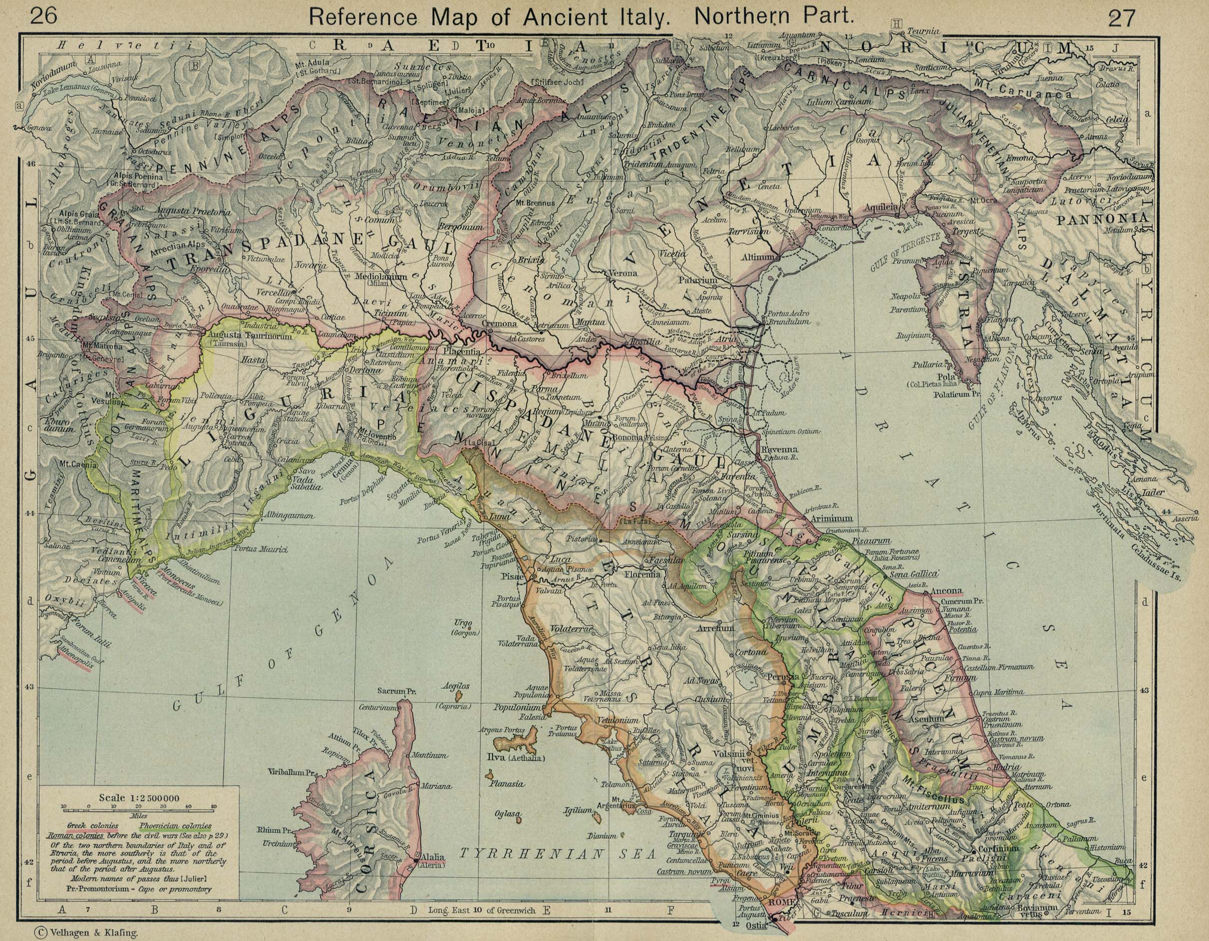
- Reference Map of Ancient Italy (Northern Part) (William Shepherd, Historical Atlas, 1926)
- Reference Map of Ancient Italy (Southern Part) (William Shepherd, Historical Atlas, 1926)
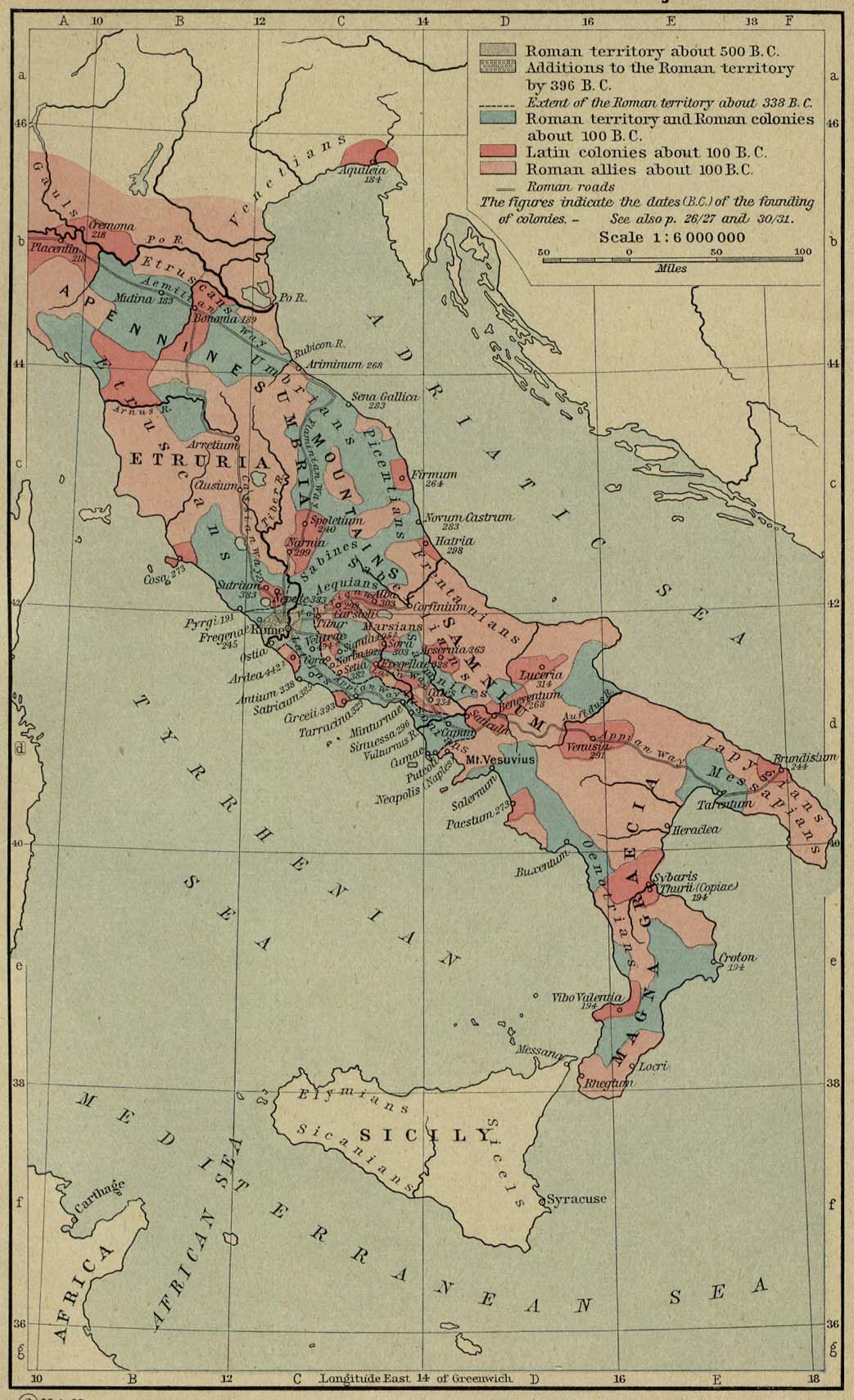
- The Growth of Roman Power in Italy (William Shepherd, Historical Atlas, 1926)
- The Spread of Roman Rule up to 218 B.C. (Putzgers Historischer Weltatlas, 1923)
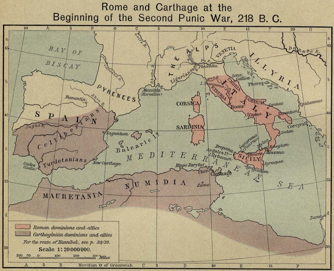
- Rome and Carthage at the Beginning of the Second Punic War, 218 B.C. (William Shepherd, Historical Atlas, 1926)
- Territorial Expansion of Rome (William Shepherd, Historical Atlas, 1926)
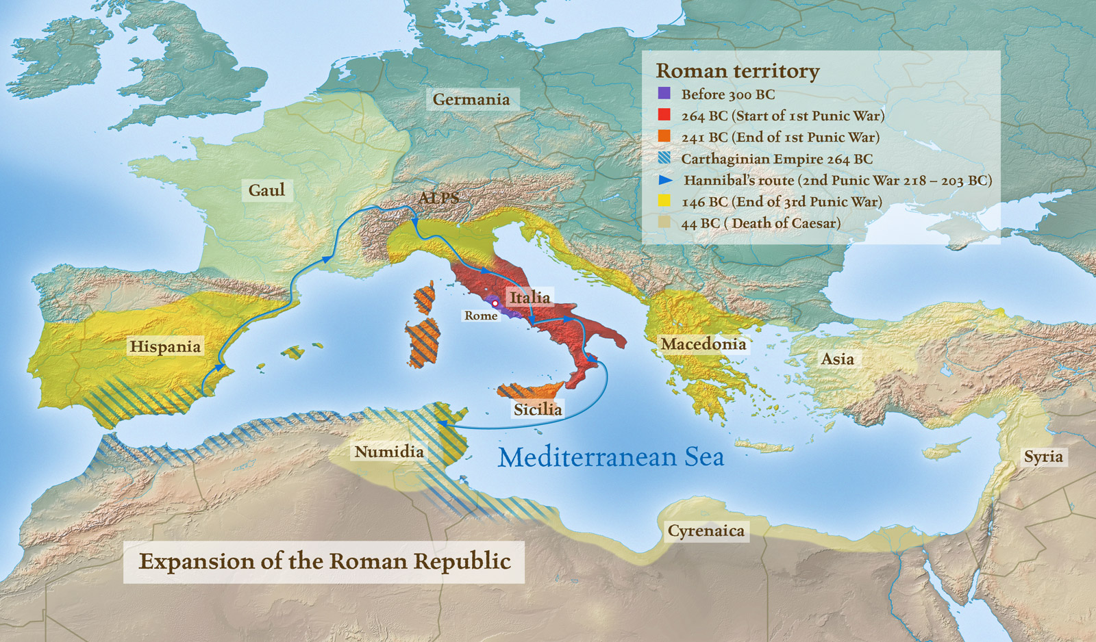
- Expansion of the Roman Republic
- Roman Territories
- Hannibal crossing of the Alps. Lake Trasimene (Putzgers Historischer Weltatlas, 1923)
- Cannae (Putzgers Historischer Weltatlas, 1923)
- Growth of the Roman Empire (Droysens Allgemeiner Historischer Handatlas, 1886)
- Organisation de l’Empire romain du Ier au IIIe siècle (Vidal-Lablache, Atlas général d'histoire et de géographie, 1912)
- Organisation de l’Empire romain à partir de Dioclétien (284) (Vidal-Lablache, Atlas gén. d'histoire et de géographie, 1912)
- The Roman Empire under Diocletian, AD 284-305
- European Provinces of the Roman Empire (Putzgers Historischer Weltatlas, 1905)
- Hispania, Mauretania et Africa (H. Kiepert)
- Reference Map of the European Provinces of the Roman Empire (William Shepherd, Historical Atlas, 1926)
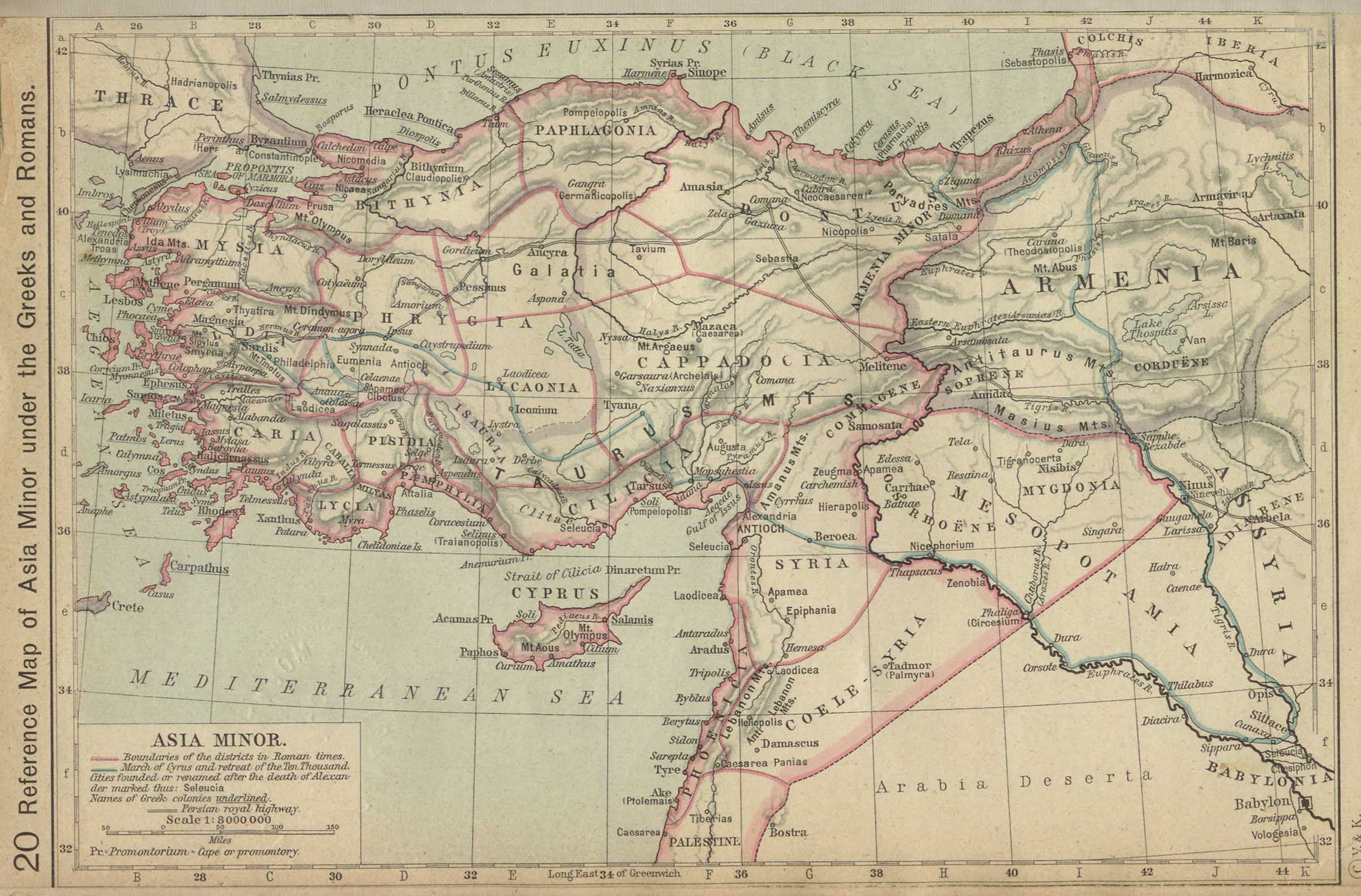
- Reference Map of Asia Minor under the Greeks and Romans (William Shepherd, Historical Atlas, 1923)
- Asia Minor (Droysens Allgemeiner Historischer Handatlas, 1886)
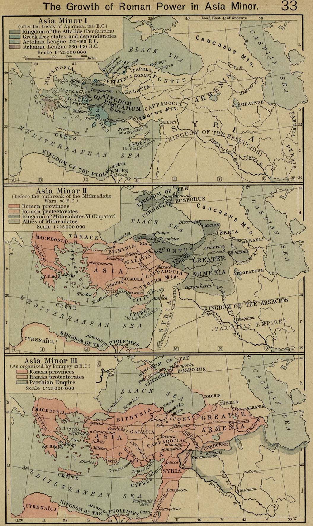
- The Growth of Roman Power in Asia Minor (William Shepherd, Historical Atlas, 1926)
- Italy at the Gallic invasion. Britain (Droysens Allgemeiner Historischer Handatlas, 1886)
- Roman Britain, circa 400 (Charles Colbeck, The Public Schools Historical Atlas, 1905)
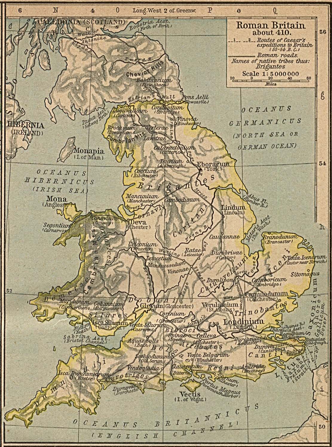
- Roman Britain about 410 (William Shepherd, Historical Atlas, 1923)
- North Africa (Droysens Allgemeiner Historischer Handatlas, 1886)
- North-west Africa (Putzgers Historischer Weltatlas, 1923)
- Gaul. Spain (Droysens Allgemeiner Historischer Handatlas, 1886)
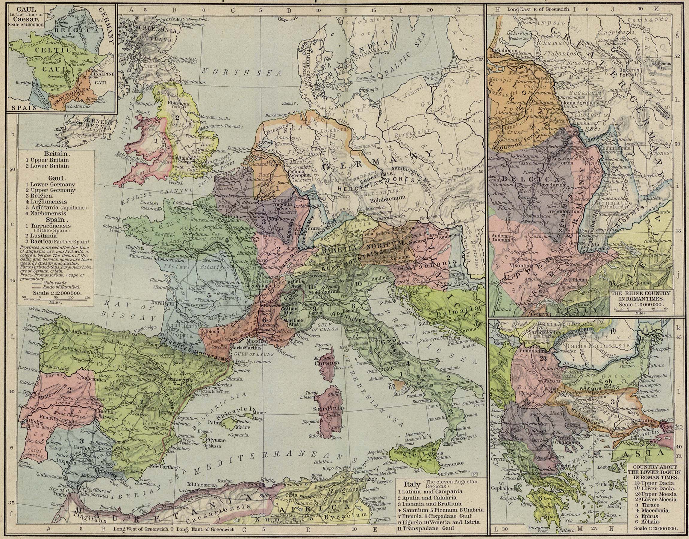
- Gaul at the time of Caesar (Putzgers Historischer Weltatlas, 1923)
- The Lands of the Lower Danube in Roman Times. Germany (Droysens Allgemeiner Historischer Handatlas, 1886)
- Germanie ancienne (Vidal-Lablache, Atlas général d'histoire et de géographie, 1912)
- Europe at the Time of the Migrations (Droysens Allgemeiner Historischer Handatlas, 1886)
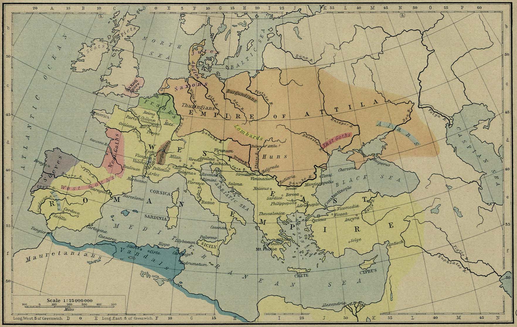
- The Roman and Hunnic Empires about 450 (William Shepherd, Historical Atlas, 1926)
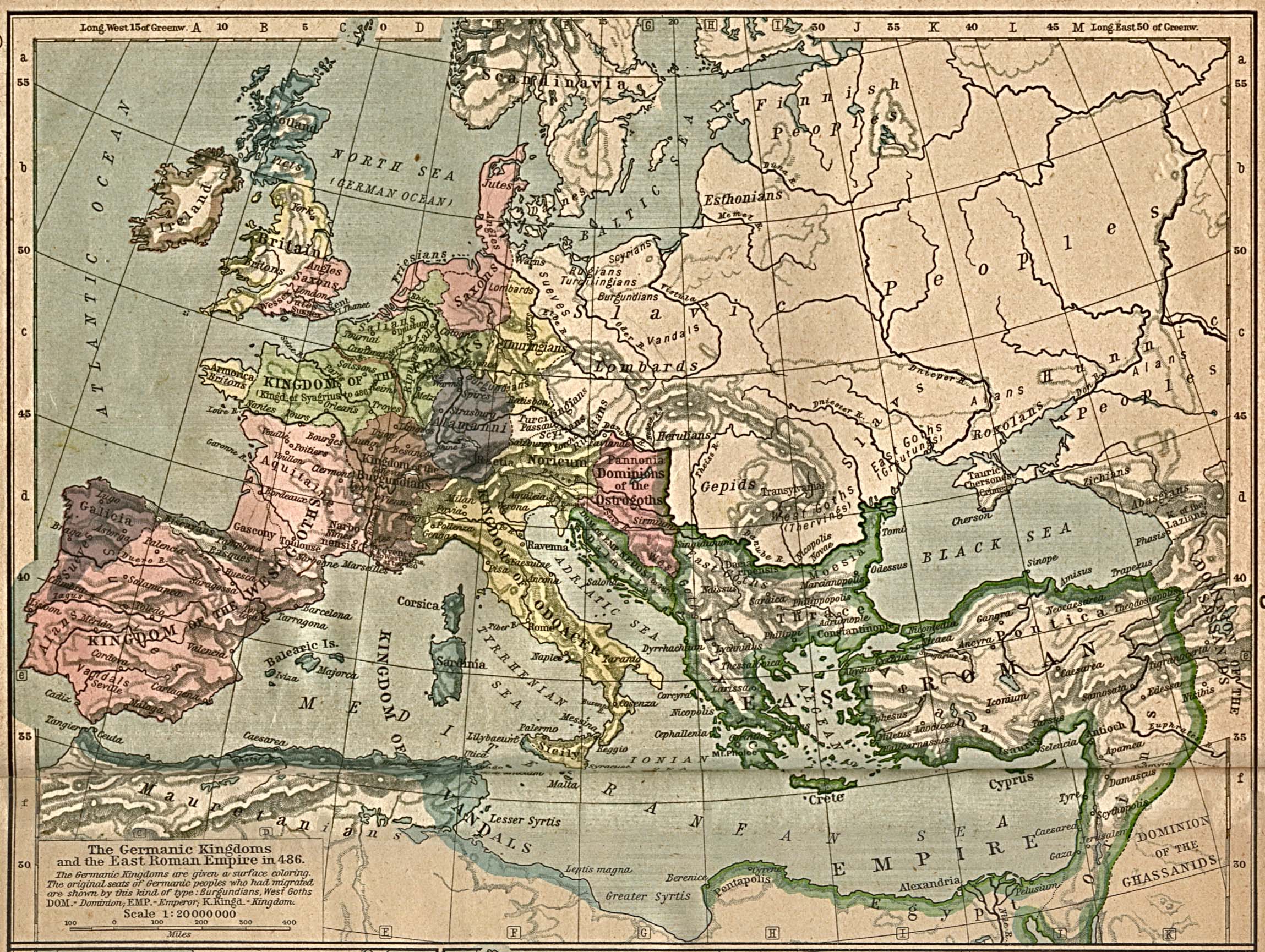
- The Germanic Kingdoms and the East Roman Empire in 486 (William Shepherd, Historical Atlas, 1923)
- The Germanic Kingdoms and the East Roman Empire in 526 (William Shepherd, Historical Atlas, 1926)
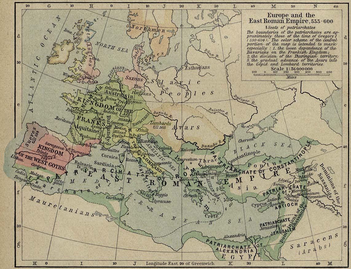
- Europe and the East Roman Empire, 533-600 (William Shepherd, Historical Atlas, 1926)